Next Exit
Take the next exit from today's headlines and find a rest stop. This week the Interstate Highway System is on Route 24's roadmap.
Route 24 is an independent newsletter for those who feel out of gas with current news cycles and elect stories that drive public trust. Three times a week new issues park in your inbox. Stop by Forward Vision and Express Lane for examples. Read more about Route 24’s recent launch and consider subscribing however you’re able. As always, thank you for joining Route 24 on the road!
Road Survey
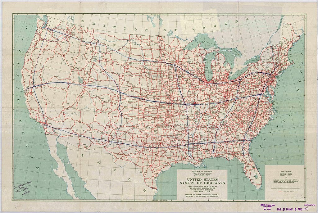
The original plan for the Interstate Highway System was drawn by hand. In 1938, President Franklin D. Roosevelt mapped out eight superhighway routes throughout the United States in blue ink. He presented the final product to then-Chief of the Bureau of Public Roads, Thomas MacDonald. By 1939, a formal report by Herbert “Jack” S. Fairbanks, Head of the Division of Information at the Bureau of Public Roads, outlined the first plans for the Interstate Highway System, which were expanded in another report by 1944.
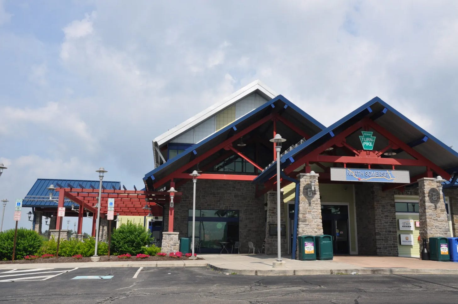
The earliest interstate highway constructed was The Pennsylvania Turnpike, earning it the nickname “The Grandfather of the Interstate System.” It spanned 162 miles of highway now known as the I-70 and I-76 between Irwin and Carlisle.
By 1955, the General Location of the National System of Interstate Highways, also known as the Yellow Book, was published and the final plans for America’s Interstate Highway System were mapped out under then-President Eisenhower with the input of the Head of General Motors, Charles Erwin Wilson, who would go on to become President Eisenhower’s Secretary of Defense. By 1956, it was signed into law.
The modern Eisenhower Interstate System, officially known as the Dwight D. Eisenhower National System of Interstate and Defense Highways, spans 47, 622 miles and includes routes ranging in distance from 18 miles to upwards of 3,000 miles from coast to coast.

Service Plaza
“Safety rest areas are the embodiment of a cultural shift. They are an ideological bridge between American automobile travel that burgeoned during the first half of the Twentieth Century and the mid-century Interstate era of high-speed, impersonal, cross-continent transportation.”
From Joanna Dowling. As published in “Safety on the Interstate: The Architecture of Rest Areas”. Spring 2008. SCA Journal. Vol. 26, No. 1.
Drive cross-country and you’ll quickly see that not all rest areas have the same design. That’s because rest area architecture was designed to provide a local space for creative expression in an otherwise standardized system.
Designers faced a unique challenge: to encourage continuous traveller use of rest areas, incorporate local cultural materials in form and style, and still comply with functionality requirements. From the late 1950s to the late 1970s, the aesthetic of rest areas was categorized: basic, traditional, modern, regional, rustic, combined form, freeform, or revival. The most well-recognized designs were displayed in the regional tepee architecture that frequented rest areas in South Dakota, Oklahoma, Colorado, Texas, and New Mexico as a tribute to the Native cultures that lived there.
Global Positioning Systems
We all know the feeling. You’re on the highway, en route to your destination, and the GPS suddenly says your favorite word: recalculating. When GPS fails, these interstate apps let you still locate a nearby rest stop.
Rest Stop Ahead monitors and tracks your transit route, with custom analysis features such as crowd size, location, and on-site amenities, to give you directions to the nearby rest stop that best fits your needs.
iExit guides you to the best interstate exits on your route, offering real-time analysis of the most affordable gas prices or closest EV charging stations, as well as hotel suggestions and food options.
Arcade Alley
To rev up our fundraising engines to present Probable Cause to the public this October, Arcade Alley gives readers a behind-the-scenes look at some of the gaming features and design approaches that have informed our creative process.
If you’ve ever played Red Light, Green Light, then you understand the basic mechanics of a racing game. In Red Light, Green Light, one person plays a traffic cop and the others react to different traffic light commands: red (freeze), green (go), or yellow (go - in slow motion). This cycle continues until someone reaches the traffic cop.
In arcade racing games, such as the 90’s video game series Sega Rally, drivers take laps on a track or highway, powering forward at top speed while dodging collisions with other drivers, passing checkpoints, and avoiding traffic obstacles. Using 3D animation and hydraulic motion simulator arcade cabinets to simulate the look and feel of driving a car, peak performance extends a driver’s game life, unlocking key features such as a different car model, until the driver completes their route.
Building on these key features, Probable Cause drivers race to respond in real-time to determine how best to move forward.
Highway Maintenance
Are you enjoying Rest Stop? If you have comments or suggestions for content you’d like to see in this space, please share your feedback.
Tread Lightly
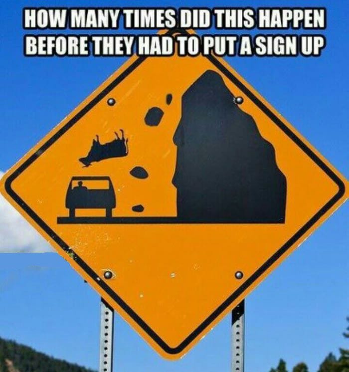
See a hilarious road sign on your daily commute or on your next road trip? Share it with Route 24 by e-mailing it to Sam at route24@substack.com for inclusion in a future edition of Rest Stop. Here’s an example.
Rest Stop strives to be a vehicle for inspiration and readers like you help to fuel the Route 24 mission.
Thank you for coming along for the ride!
Stay the course,
Sam
Are we there yet?! Route 24 just launched and needs paid subscribers to fund presenting Probable Cause to the public this October. Learn more about the project on the Route 24 About Page and share the road by restacking this post.


